
Saturday morning I drove to North Carolina to ride with a couple other Bike Forums members. Here’s the ride report I posted on the site (plus photos below):
The Southeast region Bike Forums ride began bright and early at 10 a.m. Saturday from the Pisgah Inn (near Asheville, NC). Well, it was supposed to begin then, but I arrived promptly at 10:40 a.m. Thankfully, BikeWNC and rm -rf were gracious enough to wait for me.
I went to the bathroom to change. It was a crisp, cold May morning at 5,000 feet–temperatures were in the 40s. So I reverted to winter wear: arm warmers, knee warmers, and full-finger gloves.
A few minutes making final preparations, and then we were off on the ride–a group of three riders spanning the cycling spectrum: BikeWNC, a local mountain goat; rm -rf, a flatlander from Northern Kentucky; and me, a nondescript rider from the hills of Tennessee.
After a few minutes coasting downhill on the Blue Ridge Parkway, we headed down the mountain on NC 276.
“The road is kind of rough at the top, but it gets better” BikeWNC warned. “Whatever you do, don’t cross the yellow line.” That’s always good advice.
The first three miles were a steep, curvy descent through the woods. I looked for the best line through the road bumps and tried to keep up.
Gradually, the slope eased up as we entered habited territory. Two large dogs welcomed us to civilization. BikeWNC and rm -rf responded to the barking with “howls” of their own; having met their match, the canines backed off.
The next ten miles were smooth sailing as we gradually lost elevation. We hit smoother pavement and BikeWNC and rm -rf took off, cruising at 20+ mph despite the headwind. I dialed up my wattage to keep pace. We rode through a mixed area–a nice golf course, some nice houses, some not-so-nice houses, and a healthy serving of junkyards.
We stopped at a gas station for a break. The temperature had warmed up several degrees, so we started shedding clothes. I stripped off my gloves and knee warmers.
Shortly after resuming the ride, we bid adieu to the high-speed traffic on NC 215 and turned onto the much quieter Lake Logan Road. We reached the low elevation point and slowly began climbing–first in a stretch of open countryside, then in the woods. BikeWNC told about his bid to become an Olympic kayaker.
To my surprise, we happened upon a body of water: Lake Logan. We stopped for pictures. BikeWNC told of the recreational center there.
Around mile 28 the climbing picked up. It held constant at 4-5% for a while. The road parallels a stream, though it we didn’t see it much due to the trees.
We barely encountered any traffic climbing Lake Logan Road. It was very quiet in the woods–with one notable exception. When we were about a third of the way up a high-ride pickup truck, complete with kids in the back, came roaring up the road. About 30 seconds later, it turned around and came roaring back for an encore performance. I wondered if this might turn into a developing situation, but fortunately that was the extent of the day’s redneck event.
We stopped were the road crosses the stream. It’s a very pretty spot: on the uphill side, the water cascades over a steep rock formation. On the other side, there’s a natural pool about 30 feet below. I declined the opportunity to go skinny dipping in 40 degree water. However, I did fill my water bottles with the cold water, courtesy of the nearby spring.
After the spring, we hit the first of two tougher climbing grades: a 7-8% mile-long stretch. Despite never previously having done that much climbing, rm -rf was undaunted by the mountains. He settled within his heart range and motored away. Although the elevation bothered him a bit, he never needed to stop and rest for long.
As we neared the top, the view opened up. At 5,000 feet, the leaves on the trees were still coming out. I was struck by the number of mountain balds in the area. We stopped to take pictures of a waterfall on the mountain side.
After a second short pitch we reached the Blue Ridge Parkway. We took a break at the overlook, enjoying the view. Visibility was over 50 miles. Before the ride, both rm -rf and BikeWNC had hidden provisions near the overlook. rm -rf discovered that a critter (or something) had taken his food, leaving only the water. Fortunately, wilderness-savvy BikeWNC had plenty of extra food in his non-bearproof container. We dined on fig newtons, bananas, and chocolate.
The views from the parkway were spectacular. We stopped at several more overlooks and BikeWNC pointed out highlights. Then we hit a multi-mile downhill run. I did my best to keep up. rm -rf noted that it was the longest downhill stretch he had ever done. He appeared to enjoy it.
We passed through a few tunnels. rm -rf was the only one equipped with a blinky light. Luckily, only one car approached us while we were in the darkness, and its driver saw us. So no one got run over. While we were in the second tunnel I observed that it was the longest tunnel I had ever ridden in. Fifteen seconds later, I commemorated the event by accidentally running off the road (no damage done).
The last few miles of the ride featured several short up and down stretches. Traffic was a bit heavier than before, but still not bad for a beautiful weekend day.
We got back to the inn after 4 p.m.
Ride length: 51.5 miles
Riding time: 3:41
After changing, we met again inside. The restaurant wasn’t serving, so BikeWNC and rm -rf got take-out meals. We sat on rocking chairs on the back porch talking cycling and enjoying the mountain panorama. A good time was had by all.
May 2007
Blaming Americans For 9/11
In the last Republican presidential debate Texas Rep. Ron Paul argued that terrorists who attack America are motivated, in part, by America’s Middle East policies:
“They attack us because we’ve been over there. We’ve been bombing Iraq for 10 years. … We’ve been in the Middle East,” Paul said in explaining his opposition to going to war in Iraq.
Paul’s comments have drawn scorn from the right-wing noise machine and some GOP leaders are trying to ban him from future debates.
Meanwhile, in her tribute to Jerry Falwell, Ann Coulter writes this:
Let me be the first to say: I ALWAYS agreed with the Rev. Falwell.
Actually, there was one small item I think Falwell got wrong regarding his statement after 9/11 that “the pagans, and the abortionists, and the feminists, and the gays and the lesbians — who are actively trying to make that an alternative lifestyle — the ACLU, People for the American Way, all of them who have tried to secularize America. I point the finger in their face and say, ‘You helped this happen.'”
First of all, I disagreed with that statement because Falwell neglected to specifically include Teddy Kennedy and “the Reverend” Barry Lynn.
Second, Falwell later stressed that he blamed the terrorists most of all, but I think that clarification was unnecessary. The necessary clarification was to note that God was at least protecting America enough not to allow the terrorists to strike when a Democrat was in the White House.
When will the right wing outrage machine go after Ann Coulter because she blames Americans for 9/11? I’m not holding my breath.
Film Of British Cycling Club Outing (1955)
Here’s an interesting 1955 film (two parts) on a British cycling club taking a day tour in the English countryside.
Part One
Part Two
I like how the narrator points out that many people, “especially cyclists,” eat lots of food during such an excursion. I can relate to that!
While the film’s cyclists (and their bikes) are different than today’s spandex-clad road warriors, the enjoyment both groups share transcends time.
Tuesday Flower Blogging

A nearby, unidentified flower.
Mapping Cycing Routes
One of the interesting tools to emerge for geeky bicyclists during the past few years is mapping technology. This allows users to chart a route on a map in order to obtain distance, elevation, and other information about the ride. It also lets you share a course with other people.
Standalone mapping software has been out for a number of years. But in last couple years several free websites have been launched, bringing the technology to all Internet users. Among these are:
Map It Pronto
Gmap Pedometer
Bikely
Routeslip
Map My Ride
Using the latter, here’s the ride I did Sunday:
In short, I started near Heritage High School, followed the Little River to Walland, took Walden’s Creek Road to Pigeon Forge, looped around Bluff Mountain, and returned on the north side. It’s a scenic, somewhat hilly ride. The map claims there are 6,097ft of climbing on the route. I think that due to topographical ground noise (or whatever) that figure is significantly overestimated. I suspect the actual number is somewhere in the 3,000 to 4,000 ft range. At any rate, it’s enough to give your legs a workout.
I intended to cap the ride off with a climb up the Foothills Parkway. But by the time I finished the above loop it was late enough that darkness was becoming a factor. Plus I wasn’t feeling too energetic. So I wimped out and opted for a few more miles along the Little River. All told I logged 54 sunny miles Sunday afternoon–an outstanding ending to the weekend.
3-State 3-Mountain Challenge
Saturday I did my second consecutive 3S3MC. Here’s how it went.
The day started dark and early at 4:15 a.m. I ate an energy breakfast, loaded the car, and headed out at 5:30 a.m.
My big concern going into the event was the weather. The forecast said there was an 80% chance of thunderstorms. I encountered light rain much of the drive down. When I got 25 miles from Chattanooga, it started pouring.
“Oh, great,” I thought, “How bad do I want to do this ride?”
At that point the issue seemed to be not if I would get rained on, but rather how much I would get rained on.
But fortunately the precipitation eased up when I got to Hamilton County. By the time I arrived downtown, the rain had stopped altogether. It started sprinkling again for a few minutes when the ride started, but after that it stayed dry for the rest of the day. I don’t like riding in the rain, so I was very relieved.
Upon arrival, I picked up my registration packet, changed, and prepared to ride. The convoy of 2,400 cyclists had already started rolling by the time I was ready. I eased my way into the herd and began rolling. But a couple blocks later, I realized I had forgotten to affix the registration number to my bike. So I peeled off to the side went back to the car to get it.
I must have been toward the back of the pack by the time I restarted. Perhaps because of this, the first two or three miles were really slow. Due to the congestion, I didn’t got much above 10 mph as we rolled through downtown, up the highway ramp, and over bridge across the Tennessee River. It wasn’t until a mile or so later that I finally had enough space to ride at my own pace.
After a few miles of easy riding along the river, we hit Suck Creek Mountain. According to the route description, it’s a five mile climb with a 4-6% grade. It’s really not bad; it feels like you are climbing a really long hill rather than a mountain. I guess climbing is relatively one of my strengths, because I overtook at least 80% of the riders I passed while going uphill. On Suck Creek, I found a steady rhythm at 10-11 mph and stayed in the passing lane.
After the somewhat harrowing descent off Suck Creek Mountain, I passed the first rest stop. Since it was really crowded and I didn’t need anything, I skipped it. The next 30 miles was an enjoyable section of smooth sailing across the Tennessee Valley. I’m not used to ridding such long stretches of flat road, so it was fun cruising along at 20+ mph.
Forty-two miles into the ride I made my first stop at the Marion County rest stop. An overnight downpour and heavy foot traffic had converted the food area into a mud hole, which my cleats still haven’t recovered from. I gobbled down two peanut butter and jelly sandwiches, fig newtons, and fruit. My fuel supply replenished, I headed on to the second state and mountain.
You don’t need to see the sign to know when you enter Alabama–the road tells you. Chipseal! I rode near the center line, where it was smoothest, but it’s still rough. I was glad I wasn’t on an aluminum bike.
After being jarred about for three miles I made the turn and proceeded to Sand Mountain. It’s a steeper climb: “2.5 miles at a 6-7% grade.” A couple switchbacks near the end are even steeper. Several times my rear wheel lost traction as I was toiling upward. I’m not sure if the wet road surface or my worn tire was to blame. At any rate, the climb is bad enough–it’s no fun losing power.
There’s a great overlook atop Sand Mountain which offers a scenic view on clear days. No such reward for this climb–overcast conditions obscured the valley below. So instead of enjoying the horizon, I simply enjoyed clearing the sweat from my face.
The next section of route is lightly rolling, first on Sand Mountain and then as you continue into Georgia. I took my second and last food stop at the Alabama rest area. Then I stopped again at the 80 mile rest area to rehydrate and prepare for the challenge.
Less than a mile after the stop you make an abrupt left turn and there it is: Burkhalter Gap. The first 2 miles of the mountain is a 8-10% grade. Unlike some climbs, the first mile or so if this one is fairly straight. So you can look ahead and see what looks like a long death march toward the sky.
Once you get through the base section, the climb eases up for a short stretch, just enough for you to start catching you breath. Then you go around a curve and crash against the wall: a 250-yard long piece of 14-17% grade at the top. I down shifted to my lowest gear and marshaled all available power to clear that hurdle.
After a cool down at the top, I tackled the home leg. One is tempted to think that your work is done once you conquer Burkhalter Gap. But in reality there’s still a few miles of rollers along Lookout Mountain. Fortunately none of them are very long so I was able to power through them without doing major damage.
At last I made it to the descent off Lookout Mountain. No more climbing! There was a little more traffic than I like to see on a curvy descent, but the drivers behind me were patient.
At the bottom of the mountain, traffic directors were stationed at intersections to give cyclists the right of way. But they succeeded in backing up traffic, thus making it difficult to navigate the aforementioned intersections. Oh well, the thought was nice.
I rolled through the finish line a little before 4:00 p.m., tired but happy. I did the ride in about 10 less minutes of riding than 2006. After changing, I relaxed for a while and downed six large pieces of pizza. Six hours of cycling can really stoke one’s appetite.
All in all, another great century. Nice scenery, good roads (except Alabama), a unique and varied course, and well-stocked rest stops. I hope to do it again. Thanks to the organizers and volunteers who ran the event.
Ride Statistics
Distance: 100.2 miles
Riding time: 6:09
Average speed: 16.1 mph
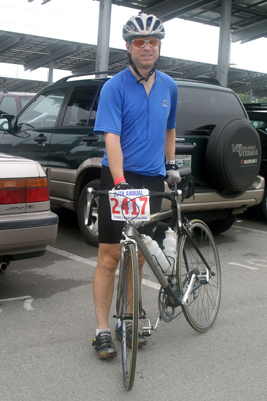
Post-ride photo:
See also Chattanooga Times Free Press, Bike Forums ride thread (I’m Velo Vol).