On 7 May 2011 I participated in my fourth 3-State 3-Mountain Challenge in Chattanooga, TN. It had been three years since I had last ridden the event, so I was eager to return. But not too excited–it still required effort to respond to the godforsaken 4:30 a.m. alarm.
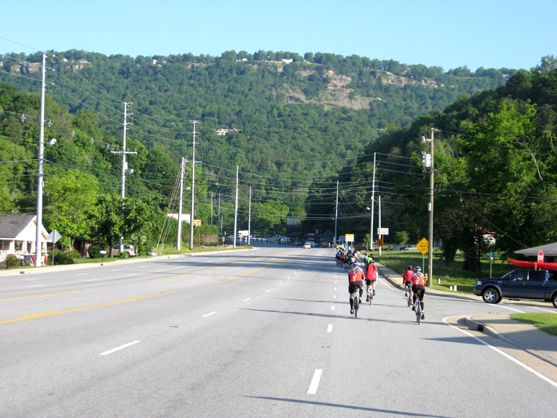
But I did arise, downed my customary pre-century tator tot breakfast, and made the 100-mile drive to the Finley Stadium staging area. By the time I gathered my registration packet and geared up, the motorcycle-led velo parade had already already started to roll. I waited a few minutes as queued cyclists slowly filed by, then joined the procession at the back of the pack.
At the start line

The first few city miles were at an easy warm-up pace, which was fitting because it was a chilly morning (low 50Fs). Within an hour it started warming up nicely and turned out to be a great day for cycling: 70Fs and dry.
Downtown Chattanooga

Crossing the Tennessee River at Chattanooga


It’s funny how accidents can occur when you least expect them. The closest I came to a mishap the entire day was minutes from the start. I glanced ahead after taking the picture of the river and discovered, to my dismay, that everyone ahead was braking due to a long backup on the exit ramp. I frantically grabbed for my brake levers and narrowly averted what would have been an embarrassing collision with cyclists in front of me.
Once I made it past the bridge off-ramp logjam, the pace picked up because there was more room to pass.
Going into the tunnel on the first hill

After the first ridge, the course followed some open, multi-lane roads, then paralleled the river for several miles. The police blocked motorized traffic in this stretch, so it was uninterrupted sailing through the hills.
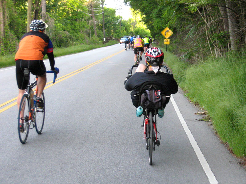
One of the interesting things about these kind of events is the diversity of pedal-pushers you see. A majority of participants are 30-50 year-old white male road cyclists from not very far away. But there are also women, seniors, tandems, recumbents, and riders of other shapes and sizes. They come from all over, too. At a picture stop I met a guy from Iowa. Judging from the labored climbing I saw from many riders, he wasn’t the only person who came from flat terrain.
Recumbent bicycle

After about 11 miles the route reaches the first “mountain,” Suck Creek Mountain. The climb itself isn’t bad (5 miles at a 4-6%), but a couple things about it were annoying.
First, the riders near the back where I was were too slow. I’m hardly the fastest rider around, but my natural climbing rhythm was 3-4 m.p.h. faster than almost everyone around me. So I went the entire way up the left side of the lane, often going into the opposite lane to pass people. I felt like Lance Armstrong, passing hundreds of riders.
The problem was that there were also cars on the road, in the opposite lane, attempting to pass going both directions. (You can see one in the picture below). It seemed more unsafe this year than on prior rides. I even saw one car passing another car that was passing cyclists . . . going around a turn! Event organizers should rethink traffic control on this mountain–it’s an accident waiting to happen.
Climbing Suck Creek Mountain

After a cool, somewhat unpleasant descent on the other side (curves + crazy cyclists are unsettling), the route changed character with a nice long stretch of valley riding. I seldom get to ride extended flat terrain so this section was a rare treat. Along the way I mingled with ad hoc pelotons and was surprised how little effort it took to maintain a 21-22 mph cruising speed in that manner.

A couple hours into the ride I decided it was time to eat, so I stopped at the second rest stop for a snack. It was at a new location this year.

Authorities were prepared for the worst

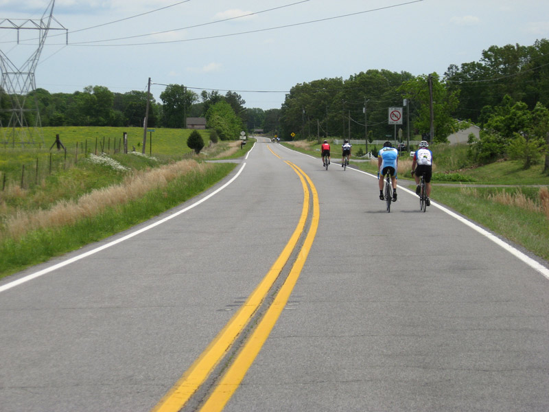
After a relaxed break, I returned to the road with renewed energy. Most of the larger groups had disappeared by this point, so I rode solo most of the remainder of the day.
Autumn SEC rivals mingle on a spring Saturday

Nickajack Lake

Bridge crossing


Approximately 50 miles into the route the ride reached Sand Mountain. Normally the course ascends the mountain on a quiet, windy back road through the woods. This year, however, it went up a state highway. (I would soon discover why).
The rerouted climb was similar in difficulty to the normal climb (2-3 miles at a 6-7% grade). It’s enough to make you work. And in my case, it brought sweat to my eyes, which always makes ascending even more miserable.
A first-time climb almost always seems worse because you don’t know how long it lasts. And, true to form, I was fooled into thinking I was approaching the top when the road leveled off, only to discover more climbing around the bend. Oh, the humanity!
Climbing Sand Mountain

One detour benefit which I thought we were going to enjoy was that we would avoid the horribly rough Alabama back roads. No such luck. Shortly after topping Sand Mountain we turned down a side road and started to rumble. I looked for as smooth a line as I could find, but there weren’t any. It was the Alabama third-world appreciation segment.
The jarring was not for naught. There was a nice overlook which offered a panoramic view of the valley. Below you could see why we had taken a different course–a tornado had gone right over the normal road.

From the mountaintop, you could trace the path of destruction for miles across the valley. I had never seen extensive tornado damage before; it was quite a spectacle.
Brown path of fallen trees

Me, enjoying the overlook

After enjoying a second round of food at the Bryant rest stop (all of which were well-stocked with sandwiches, snacks, and drinks) I followed the eastward turn toward Georgia. It’s an easy 17-mile cruise along the brow of Sand Mountain. The only remarkable thing I encountered was the number of fallen trees across Northern Alabama and Georgia. I doubt I went a mile on the backstretch without seeing at least one tree or large limb littering the wayside.
Northeast Alabama countryside
Georgia Mountains

About 70 miles into the ride I reached the second major detour. Event organizers axed the third mountain: Burkhalter Gap Road/Lookout Mountain. [Someone on a forum posted that it was because the Town of Signal Mountain opted not to support the ride.] Whatever the reason, I was disappointed because I was looking forward to testing my metal on the ride’s signature climb, which features a 16-18% grade at the top.
To add insult to injury, the revised “century” route wasn’t even 100 miles–it was approximately 88! I understand that there were extraordinary circumstances which the Chattanooga Bicycle Club could not control, but I believe they could have at least sketched out a revised 100 mile route. Fail.
Returning to the homeland

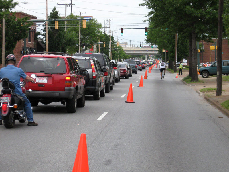
Cyclists get their own lane riding back into Chattanooga

Traffic backed up near the stadium (finish line)
After recharging with post-ride food at Finley Stadium (Subway sandwiches), curiosity got the best of me and I decided to survey storm damage up close by rerouting my drive home through Ringgold, GA, which was hit by an EF4 storm.
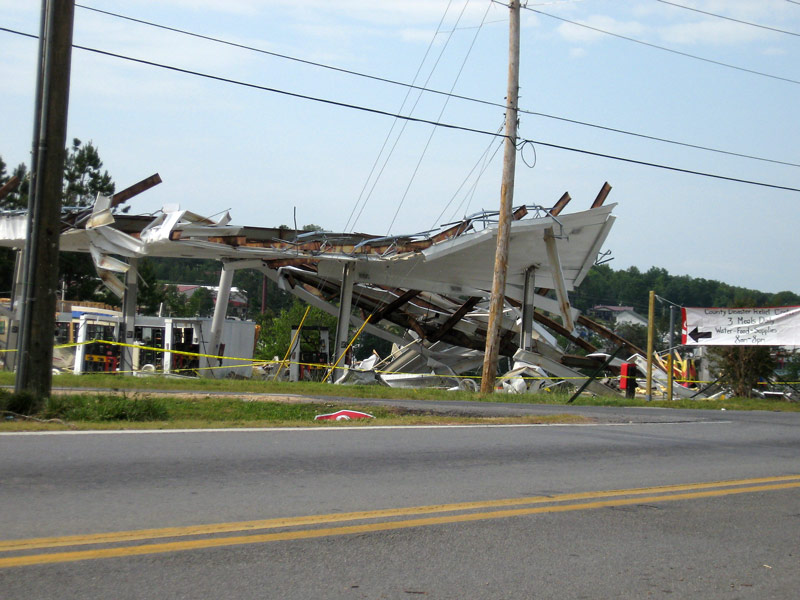
It didn’t take long to find where the storm hit–you could see the path of destruction from the highway exit ramp. I went back and forth for a mile on the exit road, looking at damaged/destroyed businesses and former gas stations.
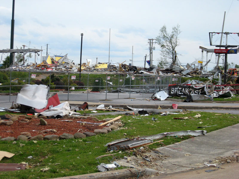

Destroyed signs

Traffic was backed up on the main roads–filled, in part, with other disaster tourists. I wasn’t sure where to go to see the full extent of the destruction when I noticed about a 1/4 mile wide brown path on the ridge to the east. I lined it up with my location, and, sure enough, I had discovered the tornado path.
I followed the rubble compass back through the business section into a several-block-wide, low-end residential area (bordered by the middle school) that had been hammered. Dozens of homes and the school itself were damaged. Workers used the parking lot of the latter as a staging area for reconstruction.
Restoring power lines

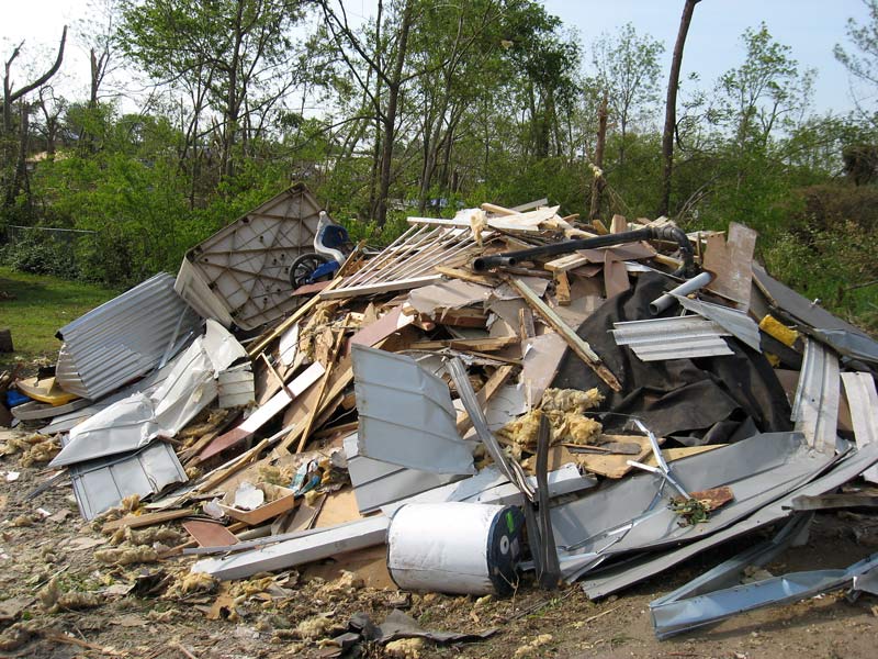

I felt conscientious about gawking where people had been killed or were trying to salvage their houses. I tried to be discreet by taking pictures from inside the car or where no one was around. The roaming sheriff cars were an additional reminder to keep a low profile.


Church remains (note the overturned vehicle in the middle


I’ve never been in a destroyed area so soon after a disaster. The devastation is much more striking in person than it appears on TV. It’s awe-inspiring witnessing how intense natural forces can transform property and trees–which took many years in the making–into rubble piles in a few seconds. I recommend that you avoid being caught in a tornado, if at all possible.
All in all, it was an eventful day. I enjoyed the spring ride in the tri-state area (except for the part that got cut off). And encountering the storm damage made me even more thankful that I had a couch awaiting at home to relax on.