On 18 June 2011 I did the Cherohala Challenge (route map).
I really enjoy this ride (this was my sixth time): it’s (fittingly) challenging, has fantastic and varied scenery, and is only a 75-minute drive away. Even so, I arrived just a few minutes before the 7:00 a.m. start time. By the time I got myself together and was rolling, it was 7:20. The late start wasn’t a problem for participating in the event–it just meant I trailed most of the other riders throughout the day.

Sunrise over Tellico Plains, TN
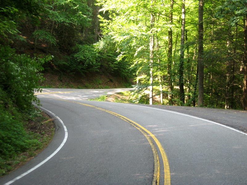
The ride started off with an easy 20-mile jaunt through the quiet Monroe County countryside. There were very few vehicles on the roads that early on a Saturday. It was pleasant cruising in the cool morning air (upper 60Fs at the start). There are some rolling hills, but no strenuous climbs. It’s a good prologue to warmed up the legs.

Morning mist in Monroe County, TN
I wasn’t the only rider who got a late start. A few minutes into the ride I happened upon a couple other cyclists. I rode with them for a bit, but our paces weren’t synchronous on the hills. Then ahead I saw someone almost crash when he ran over a water bottle that a cyclist in front of him dropped. I quickly cooled on the idea of pacelining with strangers and rode solo most of the remainder of the day.

An hour into the ride I stopped at the first rest stop to refill water bottles. Past Challenges taught me to be plenty hydrated for the long climb on the back half of the route, so I forcing down fluids all morning.
After a short stop, I turned onto Highway 411 through Vonore.

Vonore, TN
Our encounter with civilization is a brief one; the stop light in the above picture is the only one on the entire 113-mile course. After a few miles on Highway 411 (to cross a bridge) we turned off on Highway 72 and left the hamlet as abruptly as we enter it. Thereafter, you only pass a handful of gas stations the rest of the day.
I’m more of a city person by disposition and I get a bit wary when I’m in the wilderness. On this ride, the remoteness heightens the epic nature of the adventure. At times you feel like you’re at one with nature.

Little Tennessee River
After passing through some rolling terrain, the tour passes through a relatively flat inland stretch, then skirts the lake. This is usually the fastest section of the Challenge.

Highway 72 in Blount County, TN

Highway 72, Headed Toward The Mountains

Tellico Lake

Chilhowee Dam

Chilhowee Lake
At mile 44, Highway 129 leaves the lakeside and heads up into the woods in an extremely windy fashion. This section’s 318 curves in 11 miles (commonly known as the “Tail of the Dragon” http://www.tailofthedragon.com/ ) make it an attraction for motorcyclists and sports car enthusiasts.
It’s fun riding it on a bicycle, too, though not nearly exhilarating when you’re climbing at 9 m.p.h. But you’re likely to get at least blood pressure spike if you have a close encounter with a zooming crotch rocket.

Tail of the Dragon

Motorcyclists come from all over to ride the Tail of the Dragon

Calderwood Dam
Happily for me on this day I did not have a run-ins with a fellow two-wheeled road user. My only annoyance was the racket their machines generated, which marred what would otherwise be a relaxing cruise through the woods.
Tail of the Dragon
I stopped for lunch at the second rest stop (mile 54) at the Tennessee/North Carolina state line. I had worked up a good appetite in the five hours since breakfast, so I helped myself to peanut butter and jelly sandwiches, chips, bananas, energy bars, and Oreos. The support at the stops on the Cherohala Challenge is great; the volunteers are generally very encouraging and helpful.
Once you enter North Carolina at Deal’s Gap, the road descends sharply off the ridge past Cheoah Dam.

Cheoah Dam
(As seen in the movie The Fugitive.)
The route then follows the Cheoah River for about ten miles through an under-developed river gorge. The road here is a false flat; thanks to a gradual climb you ride at a speed about 3 m.p.h. slower than it feels like you should be going.

Cheoah River
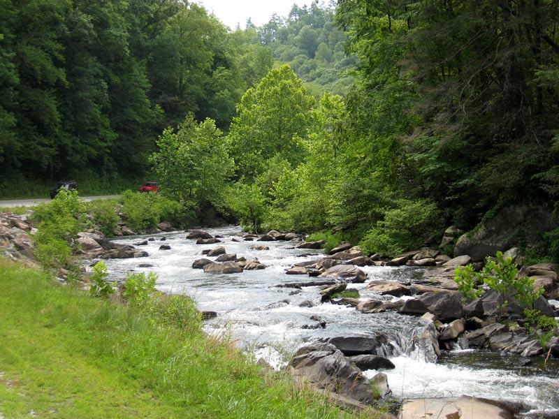
Cheoah River
For twenty-five miles on Highway 129 I had been passed by kayak-bearing vehicles, and finally I discovered why. Periodically authorities release water from the Santeetlah Dam into the river for water enthusiasts, and I happened to be riding by during such a release.
As I ambled along the river, I noticed the water volume suddenly spike and the water turned browner. Then, through the trees, I started seeing kayaks and small rafts float by.
More than once, as I labored in the mid-day heat, it occurred to me that these people in the cool water had it right, while I on a bicycle had it wrong.

Kayakers along the Cheoah River
After another liquid refill at rest area #3, I followed the turn into the woods toward Lake Santeetlah and the Joyce Killmer Wilderness. It truly is a a wilderness there; the only traffic I saw on the road for several miles was a handful of toiling cyclists.
The road past the lake features the steepest climbing to that point of the ride–a prelude of what is to come. But I was still feeling good about my progress until I started seeing dark clouds peaking through the forest canopy. Then, as I made the turn onto the Skyway access road, I heard rumbling thunder.
Uh oh.
Sure enough, a mile into the climb, the rain hit. Not a downpour (thankfully), or a prolonged shower, but enough to get all wet. And once you’re wet, you’re wet. I don’t enjoy riding in the rain, but when you are caught out in it miles from shelter, you’ve got little choice but to keep pedaling.
So I did, slowly, up the mountain. It takes a long time to do a 13-mile climb at 7-8 m.p.h., affording one plenty of time to deliberate such weighty topics as: “Why am I doing this?” “What went wrong in my childhood?” “Should I seek counseling?”
I didn’t take many pictures after the rain started because it was a pain wrapping and unwrapping the camera to keep it dry.
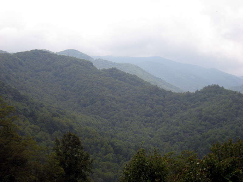
Nantahala National Forest
(If you look closely just left of center you can see two V-cuts in the mountain profile where the road goes.)
I stopped at the rest stop mid-way up the climb to take a break and dry my forehead off. One redeeming factor about the weather was that we didn’t have to climb under the hot midday sun (there’s no shade on the Skyway). Yet even on this cooler afternoon I still managed to get sweat in my eyes.

Nantahala National Forest
For much of the climb the weather held as pictured above. But when I made a turn to the other side of the ridge, near the top, I was greeted by a blast of noticeably cooler air. A few minutes later another rain shower hit, much like the one before, only colder. Then foggy clouds enveloped the mountain. It was not a welcome turn of events,

Santeetlah Overlook (highest overlook on the Skyway)
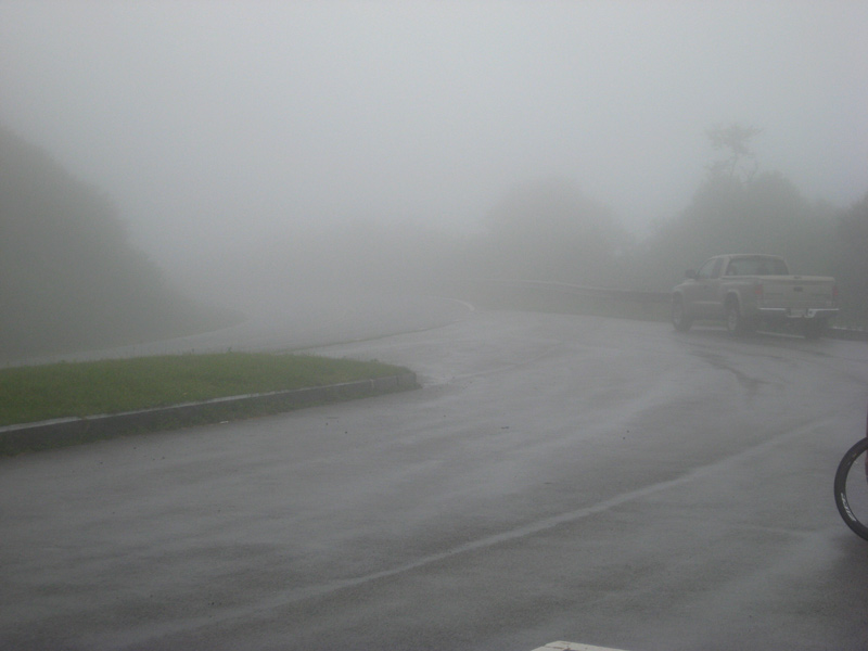
Santeetlah Overlook
It was cool and wet at the top. Normally I feel like I’ve accomplished something when I reach that point. But this time my mood was much more “meh.”
A number of riders were waiting for a van to take them down the mountain. Conditions weren’t bad enough for me to seriously consider doing that, but I was apprehensive about what Mother Nature might still bring.
The first few miles of the descent weren’t enjoyable at all. Visibility was poor, and even if it had been better I would still have been slowed because my wet brakes weren’t gripping very well. I had to ride them a lot to ensure that I didn’t loose control on the curves.
Finally, 12 miles downhill from the top, I broke through the cloud cover and could see again.

Turkey Creek Overlook
At mile 99-100 of the ride the Skyway turns off the mountainside into a stretch with some rollers mixed in. If you’re running on fumes, this is a spot where cramps can rear their ugly head. But on this day I felt as good as I ever have–tired, yes, but not on the verge of summoning the rescue team.
I was feeling victorious when I reached the Champs-Élysées run, reentering Tellico Plains (the final seven miles are downhill), but Mother Nature had the last laugh. Three miles from the finish line it started raining–as hard as it had all day. Instead of finishing in triumph, I finished soaking wet.
But that didn’t matter. Twenty minutes later, as I sat, half-wet, eating plain pasta (they ran out of sauce), all worldly discomforts had faded into white noise. I basked in a velo glow, having conquered hill and dale, sun and rain, in an all-day journey that took me right back where I started.
I had reached at the pinnacle of pointless endeavors: I was a cyclist.